Red Hook Integrated Flood Protection System
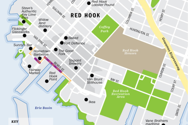
The project site is located on a peninsula in southwest Brooklyn. Red Hook has a long history related to the working waterfront and New York Harbor.
In the aftermath of the damage caused by Hurricane Sandy, analysis ensued of the waterbodies surrounding Red Hook and the potential coastal threats posed by storm surge. The NYCEDC and the Mayor’s Office of Recovery and Resiliency partnered to commission a feasibility study to identify potential ways to decrease flood risks from coastal storm surge and improve Red Hook’s overall resiliency.
Based on the feasibility assessment analysis, the city has focused on two low points in the region that are most vulnerable to coastal storm surge and sea level rise: Beard Street and Atlantic Basin. This approach maximizes coastal flood risk reduction benefits while minimizing negative impacts on the neighborhood, which was inundated with water levels as high as 3’ to 10’ at the peak of the storm surge.
The $100M project consists of mitigation in the Atlantic Basin area, including reconstruction of an existing bulkhead along Clinton Wharf and portions of Pier 11, new high-level storm sewers, drainage improvements, and a tide gate at the existing outfall. The design along Beard Street consists of a pile structure along the waterfront and a floodwall type configuration. Additionally, the proposed design includes raising the roadway and sidewalk of Beard Street to an elevation of 8 feet-NAVD.
As part of the NV5 team, IEI was selected to provide preliminary and final design services for the Red Hook Brooklyn Waterfront. The design includes flood walls, raised and regraded streets, upgraded bulkheads, and new drainage infrastructure; all of which will be fully integrated into existing structures. IEI is responsible for roadway design, sewer and watermain design, and maintenance and protection of traffic.
Services
- Civil Site
Owner
New York City Department of Design and Construction (NYCDDC)

